Herramientas de usuario
Barra lateral
El espacio de nombres
abrucena:lugares no existeabrucena:portada
El espacio de nombres
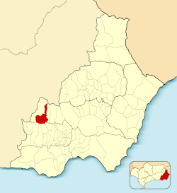
abrucena:lugares no existeAbrucena
 | ABRUCENA |  |
||||||||||||||||||||||||||||||
| Información | ||||||||||||||||||||||||||||||||
|---|---|---|---|---|---|---|---|---|---|---|---|---|---|---|---|---|---|---|---|---|---|---|---|---|---|---|---|---|---|---|---|---|
| Fundación: | Hacia el 3000 a.C | |||||||||||||||||||||||||||||||
| Coordenadas: | 37°08′N 2°47′O | |||||||||||||||||||||||||||||||
| Altitud: | 978 m | |||||||||||||||||||||||||||||||
| Comarca: | Tabernas-Filabres | |||||||||||||||||||||||||||||||
| Distancia a la capital: | 67 Km | |||||||||||||||||||||||||||||||
| Gentilicio: | Abrucenero, abrucense | |||||||||||||||||||||||||||||||
| Patrón: | San José | |||||||||||||||||||||||||||||||
| Patrona: | Virgen del Carmen | |||||||||||||||||||||||||||||||
 |
||||||||||||||||||||||||||||||||
operating instructionsVarious functions are available as part of the map. mouse/touch operation
keyboard operationKeyboard operation becomes available after activating the map using the tab key (the map will show a focus indicator ring).
It's possible that some of the functions or buttons describe above have been disabled by the page author or the administrator
|
||||||||||||||||||||||||||||||||

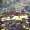


Abrucena en foto
Galería de imágenes de Abrucena
4 images
Tradiciones y festividades
- Festividad de San José
- Festividad del Corpus
- Siembra en Abrucena
- Fiestas de verano
- Fiestas de la Vega y el Camino Real
- Hogueras de San Antón
- Celebración de los quintos
- Día de la Asunción
- Fiestas en honor a San José
- Jueves lardero
- Fiestas de la Candelaria
- Cabalgata de Reyes Magos
- Romería de San Marcos
- Verbena de San Juan
Información adicional
abrucena/portada.txt · Última modificación: por bastetani